Hills of Britain and Ireland
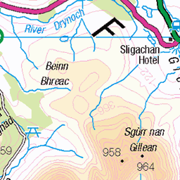
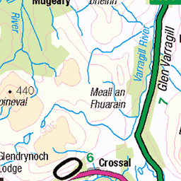
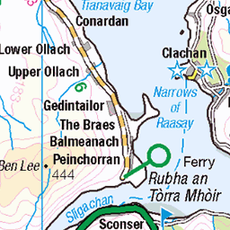
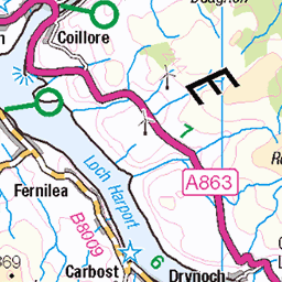
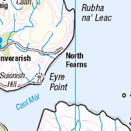
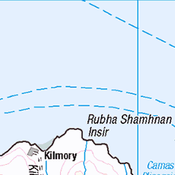
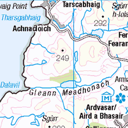
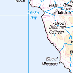
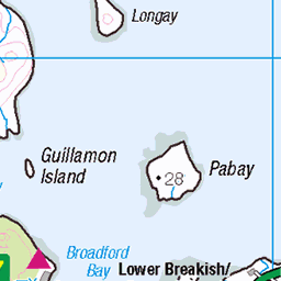
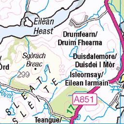
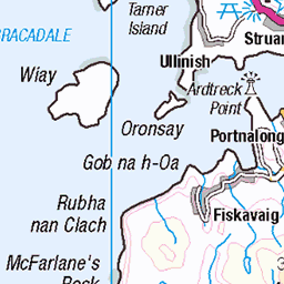
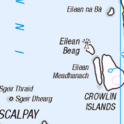
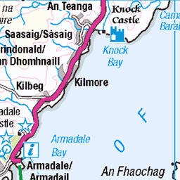
OS Map of Sgurr Dubh an Da Bheinn
Height: 939m / 3079ft • Prominence: 55m / 180ft • Summit : cairn on rock • Trip reports (hill-bagging)

Black Cuiilin Ridge
Looking along the Cuillin Ridge from above Sgùrr nan Eag.
21-Jul-21 • Russell-Davies • flickr
sgurrnaneag munro munrobagging munros blackcuillin cuillinridge cuillin skyecuillin isleofskye skye ridge ridgeline drone dronephotography highlands hiking landscape mountain mountains scotland summer summit uk 54202535871

Sgùrr nan Eag
Looking south-east past Gars-Bheinn and the culmination of the Cuillin ridge.
21-Jul-21 • Russell-Davies • flickr
sgurrnaneag isleofskye skye skyecuillin blackcuillin cuillinridge munrobagging munro munros ridge ridgeline garsbheinn highlands hiking landscape mountains scotland summer summit uk drone dronephotography 54202784638


Incredible summit view from Sgurr Alasdair, 993 metres, highest point on the 6,000 offshore islands of Britain. Left to right, Isles of Eigg, Soay, Rum, Sanday, Canna and Outer Hebrides. Glenbrittle and beach, bottom right.
Commentary. 08:00, my son, James, and I left base-camp at Glen Brittle beach. Ninety minutes in and the gentle foothills are behind us. As we stare into Coire Lagan, Sgurr Alasdair looks awesome, impenetrable, and unclimbable. As we summit the corrie’s smooth-rocked, ice-scoured lip to the corrie lake the basalt and gabbro wall of rock shows a thin grey streak of ice-shattered scree. The two thousand foot, “Great Stone Shoot,” gives a narrow but climbable rocky desert. Three hours in and we reach the col at the base of the summit. One final scramble and this view south welcomes us at 11:22. On top of the world, level with powder-puff clouds we peer down on a balmy Hebridean Sea, Rum, Soay, Rubha an Dunain peninsula, Loch Brittle and the beach campsite. Further on the horizon the southern end of the Outer Hebrides, as far as Barra, can be seen, over fifty miles distant. How this feels like a God-like throne – Shared by us – mere mortals. Panorama from Sgurr Alasdair, 993 m. (3,258 feet), Isle of Skye. Poem. A seat with the Gods. Brush the clouds. Touch the sky. Nigh on one thousand metres up on precipitous ridges of gabbro, basalt and bands of quartz. On the serrated, pinnacled, fragmented remnant ridge of a long-time extinct and exploded super-volcano. Having clambered past the Fairy Pools, The Cioch, Coire Lagan, the Inaccessible Pinnacle and two thousand foot of sharp, shattered scree making up the Great Stone Chute and the final summit arête, this is the view southwards. To stand here. And see this. It is surreal. Spiritual. An honour. A privilege. A sight that relatively few have seen. But those that have seen it, will not forget. To see for 80-100 miles in all directions. To see Ben Nevis, An Teallach, Ben More on Mull, Canna, Rum, Eigg, Muck and Soay. And to see a large part of the incredible Isle of Skye, itself, and the Outer Hebrides. It is too much to take in, too much to believe. I shall have to return and confirm that it was real, not, merely, a wonderful dream!
27-May-07 • Scotland by NJC. • flickr
54260478257

Ridges, peaks and vast corries. Panorama of the sensational Black and Red Cuillins. Key locations-Inn Pin, far left. Sgurr nan Gillean, left of centre and Bla Bheinn, far right. Taken from the summit of Sgurr Alasdair, Isle of Skye, Scotland.
Commentary. Oh, shadowy igneous, rocks. Eroded remnants of a 60 million-year-old magma chamber by glacier, constant freeze-thaw in cracks and dykes, gravity as boulders tumble, wind, rain and subsequent burns and rivers. Foreground up to top left is the Black Cuillin, mostly Gabbro with some Basalt Dyke Intrusion. Beyond these hills, towards top right, but before the sea channel is reached are the lighter-coloured Red Cuillin Hills, made of granitic intrusions. Both sets of hills produced by massive eruptions that may have emitted projectile rock and lava-flows to a volume of 15 cubic kilometres, equivalent to the Krakatoa blast. Lava-flows travelled up to 41 km. to places like the Sgurr of Eigg where rapid cooling produced glassy igneous rocks like Pitchstone or Obsidian. The Red Cuillins eroded much more evenly, hence their more even, rounded forms. The Black Cuillin is a much more dramatic erosion leaving a ten-mile serrated, knife-edge arête with frequent vertical clefts. It is raw, bare, jagged and breath-taking. Many climbers of the Himalayas, Alps, Dolomites, Andes and Rockies have loved this ridge as their training ground. Few places in the world have 360° views of sea-channels, ocean, islands, mainland, bays, beaches, headlands, peninsulas, valleys, forests and layered mountains into the distance. The views are astounding and totally captivating, simply unforgettable. In this telephoto image, we look across the huge chasm of Coir’ Uisg at the head of the valley in which lies Loch Coruisk, to the ridge called Druim nan Ramh. Beyond is the equally cavernous Harta Corrie, above which towers the iconic peak of Sgùrr nan Gillean, 964 metres (3,163 feet). Just left of centre is the highest of the Red Cuillins, Glamaig, 775 metres (2,543 feet). Across the Sound of Raasay is Applecross Bay and some of the Torridon Mountains. The highest peak, in shot, is Sgùrr Mor, part of Ben Alligin, 986 metres (3,235 feet) almost forty miles away! No wonder that the Isle of Skye is often rated one of the single most amazing islands on Earth. It undoubtedly is!
27-May-07 • Scotland by NJC. • flickr
54199646145

Summit view from Sgurr Alasdair, Isle of Skye, to the Mainland with patches of cloud-burst rain. Bla Bheinn is an outlier Black Cuillin on the left. Long. thin peninsula is Sleat. Right of centre mainland is the mouth of Loch Hourn.
Commentary. Starting at Glenbrittle Beach at 08:00 on Sunday, 27th. May, 2007, my son and I climbed 3,258 feet (993m.) from sea-level for nearly four hours. As my eyes focused on the summit, they witnessed ten other climbers who had stopped to feed, drink and relax on this magnificent summit. This was a surprise initially, but given that the summit can be approached from several starting points, perhaps not quite so surprising after all, particularly on a glorious day of clear blue sky, on Skye. We had only seen two other people near Coire Lagan approaching 1,870 feet or 570 metres. It was a privilege to hear their disbelieving stupor at the glory of this view. There were literally too many places that could be seen. From left (North) to right (South) some of the places that can be seen in shot include:- Bla Bheinn, mountain on Skye, separate from the Black Cuillin Horseshoe. The Sleat Peninsula. The Sound of Sleat. The entrance to the fjord Loch Nevis with Ladhar Bheinn, (1,020m.) above. Loch Nevis and Mallaig. The islands of Soay and Eigg. Morar and Arisaig beaches. The Ardnamurchan Peninsula and the Island of Mull. Beyond this shot, westwards and north-westwards the Outer Hebrides and the whole of the Island of Skye could be seen. Southwards, Ben More on Mull is clear, and even Ben Cruachan, in Argyll, can be seen. Northwards the Torridon Mountains, An Teallach and even some of the isolated monoliths of Sutherland can be distinguished. The extent of this view is bewildering, bemusing and incredible. What lucky people, we all were, to witness a view to die for!
27-May-07 • Scotland by NJC. • flickr
54229359336
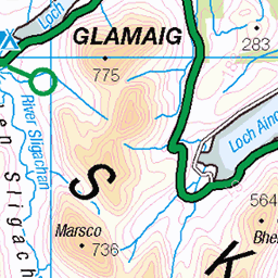
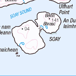
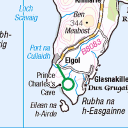
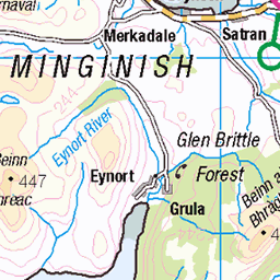
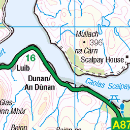
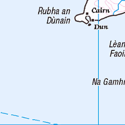
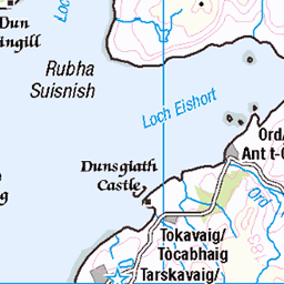
OS Map
This is OS mapping. In some areas, OpenStreetMap shows more footpaths
Spatial NI has online OSNI mapping. Click "Basemap Gallery" (4 squares icon at the top).
Now would be a good time for a cup of tea.

GPX Editor
Record map clicks
Reload map
Photos
Please tag your photos and upload them to the British and Irish Mountains group on Flickr
The other photos have been geo-tagged as on or around the summit. For less busy mountains, it can be a little hit and miss.
Black Cuiilin Ridge
Looking along the Cuillin Ridge from above Sgùrr nan Eag.
21-Jul-21 • Russell-Davies • flickr
sgurrnaneag munro munrobagging munros blackcuillin cuillinridge cuillin skyecuillin isleofskye skye ridge ridgeline drone dronephotography highlands hiking landscape mountain mountains scotland summer summit uk 54202535871
Sgùrr nan Eag
Looking south-east past Gars-Bheinn and the culmination of the Cuillin ridge.
21-Jul-21 • Russell-Davies • flickr
sgurrnaneag isleofskye skye skyecuillin blackcuillin cuillinridge munrobagging munro munros ridge ridgeline garsbheinn highlands hiking landscape mountains scotland summer summit uk drone dronephotography 54202784638
Incredible summit view from Sgurr Alasdair, 993 metres, highest point on the 6,000 offshore islands of Britain. Left to right, Isles of Eigg, Soay, Rum, Sanday, Canna and Outer Hebrides. Glenbrittle and beach, bottom right.
Commentary. 08:00, my son, James, and I left base-camp at Glen Brittle beach. Ninety minutes in and the gentle foothills are behind us. As we stare into Coire Lagan, Sgurr Alasdair looks awesome, impenetrable, and unclimbable. As we summit the corrie’s smooth-rocked, ice-scoured lip to the corrie lake the basalt and gabbro wall of rock shows a thin grey streak of ice-shattered scree. The two thousand foot, “Great Stone Shoot,” gives a narrow but climbable rocky desert. Three hours in and we reach the col at the base of the summit. One final scramble and this view south welcomes us at 11:22. On top of the world, level with powder-puff clouds we peer down on a balmy Hebridean Sea, Rum, Soay, Rubha an Dunain peninsula, Loch Brittle and the beach campsite. Further on the horizon the southern end of the Outer Hebrides, as far as Barra, can be seen, over fifty miles distant. How this feels like a God-like throne – Shared by us – mere mortals. Panorama from Sgurr Alasdair, 993 m. (3,258 feet), Isle of Skye. Poem. A seat with the Gods. Brush the clouds. Touch the sky. Nigh on one thousand metres up on precipitous ridges of gabbro, basalt and bands of quartz. On the serrated, pinnacled, fragmented remnant ridge of a long-time extinct and exploded super-volcano. Having clambered past the Fairy Pools, The Cioch, Coire Lagan, the Inaccessible Pinnacle and two thousand foot of sharp, shattered scree making up the Great Stone Chute and the final summit arête, this is the view southwards. To stand here. And see this. It is surreal. Spiritual. An honour. A privilege. A sight that relatively few have seen. But those that have seen it, will not forget. To see for 80-100 miles in all directions. To see Ben Nevis, An Teallach, Ben More on Mull, Canna, Rum, Eigg, Muck and Soay. And to see a large part of the incredible Isle of Skye, itself, and the Outer Hebrides. It is too much to take in, too much to believe. I shall have to return and confirm that it was real, not, merely, a wonderful dream!
27-May-07 • Scotland by NJC. • flickr
54260478257
Ridges, peaks and vast corries. Panorama of the sensational Black and Red Cuillins. Key locations-Inn Pin, far left. Sgurr nan Gillean, left of centre and Bla Bheinn, far right. Taken from the summit of Sgurr Alasdair, Isle of Skye, Scotland.
Commentary. Oh, shadowy igneous, rocks. Eroded remnants of a 60 million-year-old magma chamber by glacier, constant freeze-thaw in cracks and dykes, gravity as boulders tumble, wind, rain and subsequent burns and rivers. Foreground up to top left is the Black Cuillin, mostly Gabbro with some Basalt Dyke Intrusion. Beyond these hills, towards top right, but before the sea channel is reached are the lighter-coloured Red Cuillin Hills, made of granitic intrusions. Both sets of hills produced by massive eruptions that may have emitted projectile rock and lava-flows to a volume of 15 cubic kilometres, equivalent to the Krakatoa blast. Lava-flows travelled up to 41 km. to places like the Sgurr of Eigg where rapid cooling produced glassy igneous rocks like Pitchstone or Obsidian. The Red Cuillins eroded much more evenly, hence their more even, rounded forms. The Black Cuillin is a much more dramatic erosion leaving a ten-mile serrated, knife-edge arête with frequent vertical clefts. It is raw, bare, jagged and breath-taking. Many climbers of the Himalayas, Alps, Dolomites, Andes and Rockies have loved this ridge as their training ground. Few places in the world have 360° views of sea-channels, ocean, islands, mainland, bays, beaches, headlands, peninsulas, valleys, forests and layered mountains into the distance. The views are astounding and totally captivating, simply unforgettable. In this telephoto image, we look across the huge chasm of Coir’ Uisg at the head of the valley in which lies Loch Coruisk, to the ridge called Druim nan Ramh. Beyond is the equally cavernous Harta Corrie, above which towers the iconic peak of Sgùrr nan Gillean, 964 metres (3,163 feet). Just left of centre is the highest of the Red Cuillins, Glamaig, 775 metres (2,543 feet). Across the Sound of Raasay is Applecross Bay and some of the Torridon Mountains. The highest peak, in shot, is Sgùrr Mor, part of Ben Alligin, 986 metres (3,235 feet) almost forty miles away! No wonder that the Isle of Skye is often rated one of the single most amazing islands on Earth. It undoubtedly is!
27-May-07 • Scotland by NJC. • flickr
54199646145
Summit view from Sgurr Alasdair, Isle of Skye, to the Mainland with patches of cloud-burst rain. Bla Bheinn is an outlier Black Cuillin on the left. Long. thin peninsula is Sleat. Right of centre mainland is the mouth of Loch Hourn.
Commentary. Starting at Glenbrittle Beach at 08:00 on Sunday, 27th. May, 2007, my son and I climbed 3,258 feet (993m.) from sea-level for nearly four hours. As my eyes focused on the summit, they witnessed ten other climbers who had stopped to feed, drink and relax on this magnificent summit. This was a surprise initially, but given that the summit can be approached from several starting points, perhaps not quite so surprising after all, particularly on a glorious day of clear blue sky, on Skye. We had only seen two other people near Coire Lagan approaching 1,870 feet or 570 metres. It was a privilege to hear their disbelieving stupor at the glory of this view. There were literally too many places that could be seen. From left (North) to right (South) some of the places that can be seen in shot include:- Bla Bheinn, mountain on Skye, separate from the Black Cuillin Horseshoe. The Sleat Peninsula. The Sound of Sleat. The entrance to the fjord Loch Nevis with Ladhar Bheinn, (1,020m.) above. Loch Nevis and Mallaig. The islands of Soay and Eigg. Morar and Arisaig beaches. The Ardnamurchan Peninsula and the Island of Mull. Beyond this shot, westwards and north-westwards the Outer Hebrides and the whole of the Island of Skye could be seen. Southwards, Ben More on Mull is clear, and even Ben Cruachan, in Argyll, can be seen. Northwards the Torridon Mountains, An Teallach and even some of the isolated monoliths of Sutherland can be distinguished. The extent of this view is bewildering, bemusing and incredible. What lucky people, we all were, to witness a view to die for!
27-May-07 • Scotland by NJC. • flickr
54229359336

Glenbrittle Bay, Beach and Glen and Coire Lagan's Corrie Lochan from the summit of Sgurr Alasdair, Black Cuillins, Isle of Skye, Scotland.
Commentary. Rocky summit of the Isle of Skye. Sgùrr Alasdair. Threaded path- our route taken from Glen Brittle Camp Site. Swam in the bay the day before the climb. Water comfortable-15° Celsius-Gulf Stream. Trekked to the corrie loch of Coire Lagan at 570 metres. Blue-sky day, balmy and warm. After Lagan ascended 1,500 foot of scree, the “Great Stone Chute.” One final Grade 2 clamber along an arête and on top of the world. Seeing islands and mountains and bays and headlands from 20-50 miles away. Breath-taking, simply wonderful!
27-May-07 • Scotland by NJC. • flickr
54282773828

Glenbrittle Bay, Beach and Glen and Coire Lagan's Corrie Lochan from the summit of Sgurr Alasdair, Black Cuillins, Isle of Skye, Scotland.
Commentary. Rocky summit of the Isle of Skye. Sgùrr Alasdair. Threaded path- our route taken from Glen Brittle Camp Site. Swam in the bay the day before the climb. Water comfortable-15° Celsius-Gulf Stream. Trekked to the corrie loch of Coire Lagan at 570 metres. Blue-sky day, balmy and warm. After Lagan ascended 1,500 foot of scree, the “Great Stone Chute.” One final Grade 2 clamber along an arête and on top of the world. Seeing islands and mountains and bays and headlands from 20-50 miles away. Breath-taking, simply wonderful!
27-May-07 • Scotland by NJC. • flickr
54184301406

Inaccessible Pinnacle from Sgurr Alasdair, Black Cuillins, Isle of Skye, Scotland.
Commentary. The ten mile horseshoe ridge of the Black Cuillins of Skye is spectacular and awesome to the nth. degree. On a clear day they afford views of 80-100 miles, north, south, east and west. Their location at the centre of an amazing island give endless mountain and island-studded seascapes made up of over fifty large, small, mountainous, hilly and flat Hebridean islands. What they lack in the myriad of green, blue, brown, tan and purple hues of the mainland Highlands, these grey volcanic peaks make up for in pure, brutal, raw, breath-taking, magnificence. The drama of their precipitous, angular, serrated ridge is stupendous and unforgettable, even other-worldly. The Inn Pinn, seen here, is often the last of 282 “Munros” to be tackled, due to a marked increase in its technical difficulty.
27-May-07 • Scotland by NJC. • flickr
54271710577

Inaccessible Pinnacle and Great Stone Chute from the col near the summit of Sgurr Alasdair. Rugged grandeur, extraordinaire. Isle of Skye, Scotland.
Commentary. Slate grey basalt and black gabbro, precipitous igneous rocks. The highest ridges of the Black Cuillins. An ancient rocky rim, remnant of a blown super-volcano. Now shattered by global cooling, in the deep ice ages. One thousand five hundred feet of ice-riven rock, provides a rough track in or out. Grand, brutal, stark, awesome. A lift to the body, soul, spirit and mind. Distant views of mountainous islands, headlands, ocean and mainland can distract from the precarious ridge. At your peril !!!
27-May-07 • Scotland by NJC. • flickr
54299870681
Videos
Sgurr nan Eag (3031ft) & Sgurr Dubh Mor (3097ft) via Coir a Ghrunnda Filmed with Dji Mavic Air and Huawei P Smart,with Mr ...
A wee scramble in and around the South Cuillin Ridge with great views and awesome scrambling.
Sgùrr na Strì from Sligachan, on a nice snowy spring day. Route Description ...
Notes
- Data: Database of British and Irish Hills v18.2
- Maps: We use OS mapping for England, Scotland, Wales, and the Isle of Man. Sadly, Channel Islands, Northern (OSNI) and Southern Ireland (OSI) mapping isn't available online, so we use Openstreetmap.