Hills of Britain and Ireland
OS Map of Beinn na Greine
Height: 417m / 1368ft • Prominence: 266m / 873ft • Summit : trig point surrounded by stone shelter • Trip reports (hill-bagging)

Écosse, Île de Skye, Route A87, Toujours des moutons
20-Sep-24 • Marie Thérèse Hébert & Jean Robert Thibault • flickr
54170981338

Heatherfield on Loch Portree
14-Jul-24 • Piedmont Fossil • flickr
scotland uk unitedkingdom hollandamerica cruise isleofskye 53936448119

the Cuillin of Skye
scotland travel sky mountain nature grass photography isleofskye hiking hill meadow nopeople tourist valley land majestic cuillins mountainrange tranquilscene remotelocation agriculturalfield traveldestinations mountainpeak ruralscene beautyinnature landscapescenery scenicsnature rockobject outdoors idyllic scottishhighlands scottishculture 53602109934

PA139662-1
OLYMPUS DIGITAL CAMERA
12-Oct-18 • RiverboyChen • flickr
國外旅遊 歐洲 英國 蘇格蘭 skyeisland 蘇格蘭高地 highlandscotland 44006915170

PA139663
OLYMPUS DIGITAL CAMERA
12-Oct-18 • RiverboyChen • flickr
國外旅遊 歐洲 英國 蘇格蘭 skyeisland 蘇格蘭高地 highlandscotland 44910112455

PA139667
OLYMPUS DIGITAL CAMERA
12-Oct-18 • RiverboyChen • flickr
國外旅遊 歐洲 英國 蘇格蘭 skyeisland 蘇格蘭高地 highlandscotland 45774321302
OS Map
This is OS mapping. In some areas, OpenStreetMap shows more footpaths
Spatial NI has online OSNI mapping. Click "Basemap Gallery" (4 squares icon at the top).
Now would be a good time for a cup of tea.
GPX Editor
Record map clicks
Reload map
Photos
Please tag your photos and upload them to the British and Irish Mountains group on Flickr
The other photos have been geo-tagged as on or around the summit. For less busy mountains, it can be a little hit and miss.
Écosse, Île de Skye, Route A87, Toujours des moutons
20-Sep-24 • Marie Thérèse Hébert & Jean Robert Thibault • flickr
54170981338
Heatherfield on Loch Portree
14-Jul-24 • Piedmont Fossil • flickr
scotland uk unitedkingdom hollandamerica cruise isleofskye 53936448119
the Cuillin of Skye
scotland travel sky mountain nature grass photography isleofskye hiking hill meadow nopeople tourist valley land majestic cuillins mountainrange tranquilscene remotelocation agriculturalfield traveldestinations mountainpeak ruralscene beautyinnature landscapescenery scenicsnature rockobject outdoors idyllic scottishhighlands scottishculture 53602109934
PA139662-1
OLYMPUS DIGITAL CAMERA
12-Oct-18 • RiverboyChen • flickr
國外旅遊 歐洲 英國 蘇格蘭 skyeisland 蘇格蘭高地 highlandscotland 44006915170
PA139663
OLYMPUS DIGITAL CAMERA
12-Oct-18 • RiverboyChen • flickr
國外旅遊 歐洲 英國 蘇格蘭 skyeisland 蘇格蘭高地 highlandscotland 44910112455
PA139667
OLYMPUS DIGITAL CAMERA
12-Oct-18 • RiverboyChen • flickr
國外旅遊 歐洲 英國 蘇格蘭 skyeisland 蘇格蘭高地 highlandscotland 45774321302


Scots2018_0625
A87 Motorways towards Sligachan, Portree, The Isle of Skye, Highland, Scotland, UK
13-May-18 • wallacefsk • flickr
gb greatbritain highland landscape portree scotland theisleofskye uk unitedkingdom 英國 蘇格蘭 波特里 53574982632

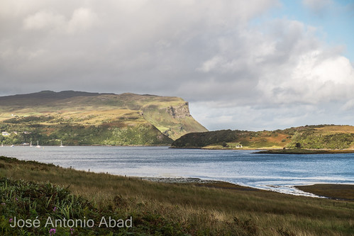
Loch Portree, Isle of Skye, Scotland
31-Aug-16 • Jose Antonio Abad • flickr
alba escocia fiordo firth highland isladeskye joséantonioabad lanscape loch naturaleza paisaje pública reinounido scotland skye unitedkingdom agua fjord nature water 34382395443

1229 Beinn na Greine b
Grid reference : NG 45961 41623 map Type : Pillar Condition : Good Good condition Flush Bracket : S9742 OSGB36 Station : NG24/35 Current use : none Historic use : Secondary T:UK waypoint : TP1210 County : Highland Region
08-May-16 • Dugswell2 • flickr
marilyn isleofskye hump trigpoint tump p269 vanessatrig beinnnagreine 26539582164
Videos
None found
Notes
- Data: Database of British and Irish Hills v18.2
- Maps: We use OS mapping for England, Scotland, Wales, and the Isle of Man. Sadly, Channel Islands, Northern (OSNI) and Southern Ireland (OSI) mapping isn't available online, so we use Openstreetmap.