Hills of Britain and Ireland
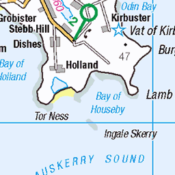
OS Map of The Wart

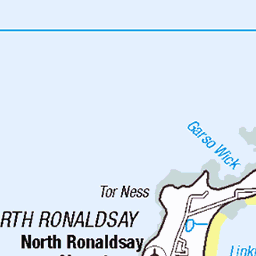
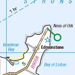
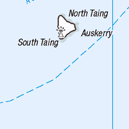
12234 The Wart
Bagged the trig, dovecot and SIB summit with Tim Hawkes. Name:The Wart Hill number:12234 Height:66m / 217ft Parent (Ma):none RHB Section:23: Orkney Islands County/UA:Orkney Islands (UA) Island:Sanday (Orkney) Maritime area:Orkney - North Class:Tump (0-99m), SIB Grid ref:HY 63033 37703 Summit feature:no feature Drop:66m Col:Sea Observations:summit is 2m from dovecote and 15m SSE of trig point; top 500m SSW at HY 62803 37260 is probably lower
14-Aug-22 • Dugswell2 • flickr
orkneyislands islandsanday sanday trigpoint islandhighpoint thewart p66 tump sib 10645 warsettertrigpoint dovecot 52317147178

12234 The Wart b
14-Aug-22 • Dugswell2 • flickr
orkneyislands islandsanday sandaisland trigpoint islandhighpoint thewart p66 tump sib 10645 warsettertrigpoint dovecot 52316831591

12234 The Wart e
14-Aug-22 • Dugswell2 • flickr
orkneyislands islandsanday sanday timhawkes headabovesummit islandhighpoint thewart p66 tump sib dovecot 52317294190

12234 The Wart a
14-Aug-22 • Dugswell2 • flickr
orkneyislands islandsanday sanday trigpoint islandhighpoint thewart p66 tump sib 10645 warsettertrigpoint dovecot 52316055432


End of the road
When a sign warns you of something, you should usually follow it....or end up reversing down a road for 100 metres!
07-May-13 • Paddy_Simpson • flickr
road sign scotland scenery paradise post redsky isolated endoftheline orkneyislands 8735762787
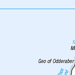
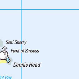
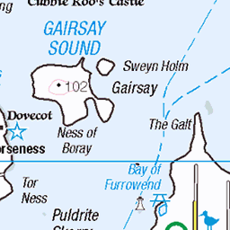
OS Map
This is OS mapping. In some areas, OpenStreetMap shows more footpaths
Spatial NI has online OSNI mapping. Click "Basemap Gallery" (4 squares icon at the top).
Now would be a good time for a cup of tea.


GPX Editor
Record map clicks
Reload map
Photos
Please tag your photos and upload them to the British and Irish Mountains group on Flickr
The other photos have been geo-tagged as on or around the summit. For less busy mountains, it can be a little hit and miss.
12234 The Wart
Bagged the trig, dovecot and SIB summit with Tim Hawkes. Name:The Wart Hill number:12234 Height:66m / 217ft Parent (Ma):none RHB Section:23: Orkney Islands County/UA:Orkney Islands (UA) Island:Sanday (Orkney) Maritime area:Orkney - North Class:Tump (0-99m), SIB Grid ref:HY 63033 37703 Summit feature:no feature Drop:66m Col:Sea Observations:summit is 2m from dovecote and 15m SSE of trig point; top 500m SSW at HY 62803 37260 is probably lower
14-Aug-22 • Dugswell2 • flickr
orkneyislands islandsanday sanday trigpoint islandhighpoint thewart p66 tump sib 10645 warsettertrigpoint dovecot 52317147178
12234 The Wart b
14-Aug-22 • Dugswell2 • flickr
orkneyislands islandsanday sandaisland trigpoint islandhighpoint thewart p66 tump sib 10645 warsettertrigpoint dovecot 52316831591
12234 The Wart e
14-Aug-22 • Dugswell2 • flickr
orkneyislands islandsanday sanday timhawkes headabovesummit islandhighpoint thewart p66 tump sib dovecot 52317294190
12234 The Wart a
14-Aug-22 • Dugswell2 • flickr
orkneyislands islandsanday sanday trigpoint islandhighpoint thewart p66 tump sib 10645 warsettertrigpoint dovecot 52316055432
End of the road
When a sign warns you of something, you should usually follow it....or end up reversing down a road for 100 metres!
07-May-13 • Paddy_Simpson • flickr
road sign scotland scenery paradise post redsky isolated endoftheline orkneyislands 8735762787
Videos
None found
Notes
- Data: Database of British and Irish Hills v18.2
- Maps: We use OS mapping for England, Scotland, Wales, and the Isle of Man. Sadly, Channel Islands, Northern (OSNI) and Southern Ireland (OSI) mapping isn't available online, so we use Openstreetmap.