Hills of Britain and Ireland
OS Map of Meall nan Caorach
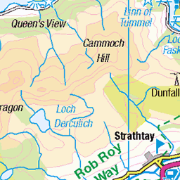
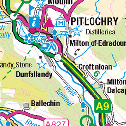
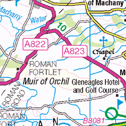
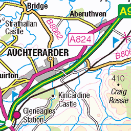
Height: 624m / 2046ft • Prominence: 322m / 1056ft • Summit : collapsed cairn/shelter 2m E of trig point • Trip reports (hill-bagging)

S5467 - Meall Nan Caoraich
NN928338, LR52. HISTORY Pillar completed 15th June 1949 costing £18.1s.0d. Computed as secondary triangulation station NO02/16 within the Perth block, and levelled to second class precision during 1951. Last maintained by the Ordnance Survey in November 1986. SITE VISIT Approached from NW. Parked in wide track entrance to Girron, by east side of road at NN903356. Followed estate track to NN924338, then up feint non continuous path through grazing slope to summt. Pillar in fair condition. Spider retains original OS centre cap with shallow engraved letters. Flush bracket faces WNW, compass measurement 291°. Vented through NE and SW sight holes. Full 360° panoramic view. Photographed 26th August 2017, GRP. ═════════════════════════ Interactive index: www.google.com/maps/d/viewer?mid=1arx2Qmo5mVeVUJA2lzVG_uzbYPW59ffh&ll=56.484903,-3.741269&z=11" rel="noreferrer nofollow Google My Maps ═════════════════════════ Neighbouring Triangulation Pillars www.flickr.com/photos/13460108@N06/8097999992/in/album-72157631793900484/ S6180 - Meall Reamhar : 3.32 miles to the west. www.flickr.com/photos/13460108@N06/8098013105/in/album-72157631793900484/ S6472 - Meall Tarsuinn : 4.09 miles to the southwest. www.flickr.com/photos/13460108@N06/8097992718/in/album-72157631793900484/ S6021 - Keilour : 5.27 miles to the southeast. www.flickr.com/photos/13460108@N06/7905744342/in/album-72157631348956488/ S1589 - Meall Dearg : 5.40 miles to the northwest. www.flickr.com/photos/13460108@N06/8097982693/in/album-72157631793900484/ S6099 - Murrays Hill : 5.42 miles to the south. www.flickr.com/photos/13460108@N06/8097983821/in/album-72157631793900484/ S6043 - Shannoch : 5.70 miles to the east. ═════════════════════════
26-Aug-17 • Graeme5015 • flickr
s5467 meallnancaoraich 8103188677
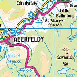
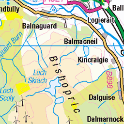
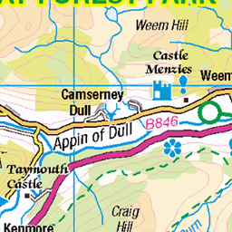
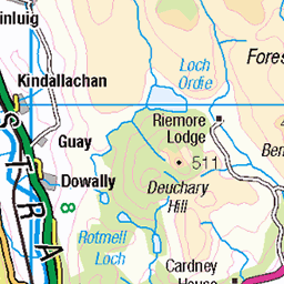
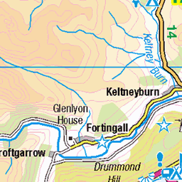
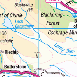
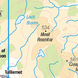
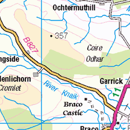
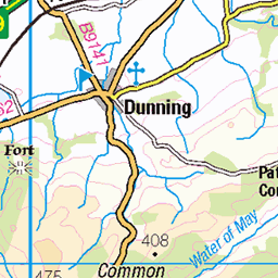
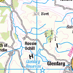
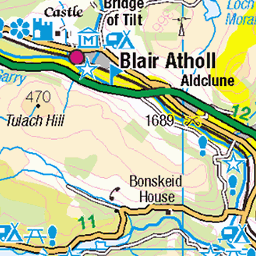
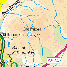
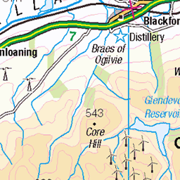
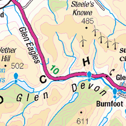
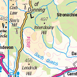
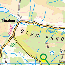
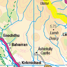
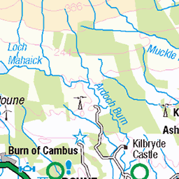
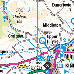
OS Map
This is OS mapping. In some areas, OpenStreetMap shows more footpaths
Spatial NI has online OSNI mapping. Click "Basemap Gallery" (4 squares icon at the top).
Now would be a good time for a cup of tea.

GPX Editor
Record map clicks
Reload map
Photos
Please tag your photos and upload them to the British and Irish Mountains group on Flickr
The other photos have been geo-tagged as on or around the summit. For less busy mountains, it can be a little hit and miss.
S5467 - Meall Nan Caoraich
NN928338, LR52. HISTORY Pillar completed 15th June 1949 costing £18.1s.0d. Computed as secondary triangulation station NO02/16 within the Perth block, and levelled to second class precision during 1951. Last maintained by the Ordnance Survey in November 1986. SITE VISIT Approached from NW. Parked in wide track entrance to Girron, by east side of road at NN903356. Followed estate track to NN924338, then up feint non continuous path through grazing slope to summt. Pillar in fair condition. Spider retains original OS centre cap with shallow engraved letters. Flush bracket faces WNW, compass measurement 291°. Vented through NE and SW sight holes. Full 360° panoramic view. Photographed 26th August 2017, GRP. ═════════════════════════ Interactive index: www.google.com/maps/d/viewer?mid=1arx2Qmo5mVeVUJA2lzVG_uzbYPW59ffh&ll=56.484903,-3.741269&z=11" rel="noreferrer nofollow Google My Maps ═════════════════════════ Neighbouring Triangulation Pillars www.flickr.com/photos/13460108@N06/8097999992/in/album-72157631793900484/ S6180 - Meall Reamhar : 3.32 miles to the west. www.flickr.com/photos/13460108@N06/8098013105/in/album-72157631793900484/ S6472 - Meall Tarsuinn : 4.09 miles to the southwest. www.flickr.com/photos/13460108@N06/8097992718/in/album-72157631793900484/ S6021 - Keilour : 5.27 miles to the southeast. www.flickr.com/photos/13460108@N06/7905744342/in/album-72157631348956488/ S1589 - Meall Dearg : 5.40 miles to the northwest. www.flickr.com/photos/13460108@N06/8097982693/in/album-72157631793900484/ S6099 - Murrays Hill : 5.42 miles to the south. www.flickr.com/photos/13460108@N06/8097983821/in/album-72157631793900484/ S6043 - Shannoch : 5.70 miles to the east. ═════════════════════════
26-Aug-17 • Graeme5015 • flickr
s5467 meallnancaoraich 8103188677
Videos
None found
Notes
- Data: Database of British and Irish Hills v18.2
- Maps: We use OS mapping for England, Scotland, Wales, and the Isle of Man. Sadly, Channel Islands, Northern (OSNI) and Southern Ireland (OSI) mapping isn't available online, so we use Openstreetmap.