Hills of Britain and Ireland
OS Map of Creag an Duine (An Sgurr)

Assynt peaks from Seana Bhraigh
A fabulous view of the Assynt peaks looking NW from the summit of remote munro Seana Bhraigh; Ben Mor Coigach on the left, Stac Pollaidh dead-centre, then Cul Beag, Cul Mor and Suilven on the right.
12-Sep-23 • OutdoorMonkey • flickr
scotland seanabhraigh highlands outside outdoor rural nature natural scenic scenery countryside wild wilderness remote mountain mountains peak summit munro assynt summitshelter cairn 53212568097

Luchd Coire
A view across the amazing Luchd Coire from the summit of Seana Bhraigh, way out in the wilderness SW of Ullapool.
12-Sep-23 • OutdoorMonkey • flickr
scotland seanabhraigh highlands outside outdoor rural nature natural scenic scenery countryside wild wilderness remote creaganduine luchdcoire ridge mountain mountains peak summit munro 53212567932

Seana Bhraigh cliffs
Cliffs below the summit of Seana Bhraigh and a view to distant Assynt peaks.
12-Sep-23 • OutdoorMonkey • flickr
scotland seanabhraigh highlands outside outdoor rural nature natural scenic scenery countryside wild wilderness remote mountain mountains peak summit munro 53213760718

Loch Luchd Coire
Looking NE down Seana Bhraigh's Luchd Coire and to the Creag an Duine ridge
12-Sep-23 • OutdoorMonkey • flickr
scotland seanabhraigh highlands outside outdoor rural nature natural scenic scenery countryside wild wilderness remote luchdcoire creaganduine ridge mountain mountains peak summit munro 53213880164


Coigach-Assynt hills
seen from a lochan below Seana Braigh
19-Sep-17 • Mr Trekker • flickr
coigach assynt mountains lochan 36909494214
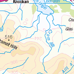
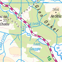
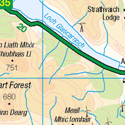
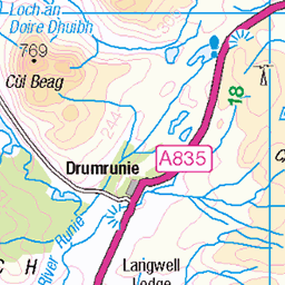
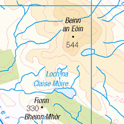
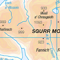
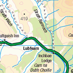
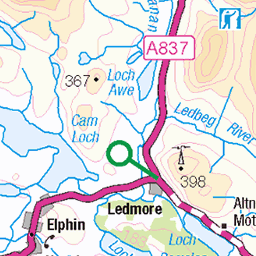
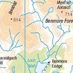
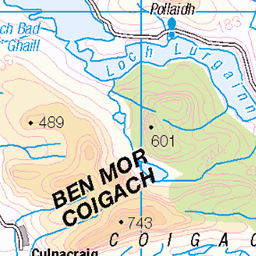
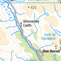
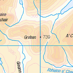
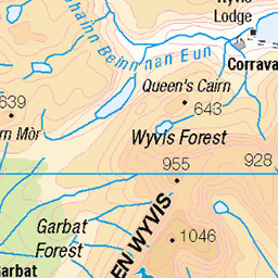
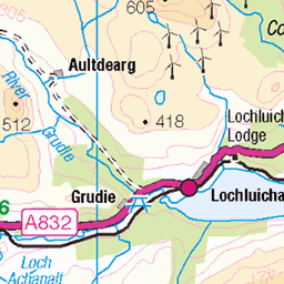
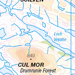
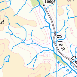
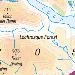
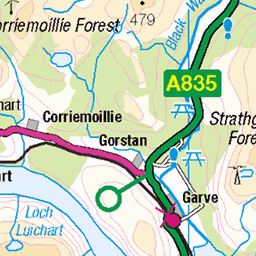
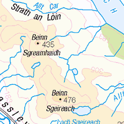
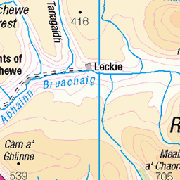
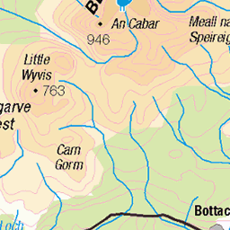
OS Map
This is OS mapping. In some areas, OpenStreetMap shows more footpaths
Spatial NI has online OSNI mapping. Click "Basemap Gallery" (4 squares icon at the top).
Now would be a good time for a cup of tea.


GPX Editor
Record map clicks
Reload map
Photos
Please tag your photos and upload them to the British and Irish Mountains group on Flickr
The other photos have been geo-tagged as on or around the summit. For less busy mountains, it can be a little hit and miss.
Assynt peaks from Seana Bhraigh
A fabulous view of the Assynt peaks looking NW from the summit of remote munro Seana Bhraigh; Ben Mor Coigach on the left, Stac Pollaidh dead-centre, then Cul Beag, Cul Mor and Suilven on the right.
12-Sep-23 • OutdoorMonkey • flickr
scotland seanabhraigh highlands outside outdoor rural nature natural scenic scenery countryside wild wilderness remote mountain mountains peak summit munro assynt summitshelter cairn 53212568097
Luchd Coire
A view across the amazing Luchd Coire from the summit of Seana Bhraigh, way out in the wilderness SW of Ullapool.
12-Sep-23 • OutdoorMonkey • flickr
scotland seanabhraigh highlands outside outdoor rural nature natural scenic scenery countryside wild wilderness remote creaganduine luchdcoire ridge mountain mountains peak summit munro 53212567932
Seana Bhraigh cliffs
Cliffs below the summit of Seana Bhraigh and a view to distant Assynt peaks.
12-Sep-23 • OutdoorMonkey • flickr
scotland seanabhraigh highlands outside outdoor rural nature natural scenic scenery countryside wild wilderness remote mountain mountains peak summit munro 53213760718
Loch Luchd Coire
Looking NE down Seana Bhraigh's Luchd Coire and to the Creag an Duine ridge
12-Sep-23 • OutdoorMonkey • flickr
scotland seanabhraigh highlands outside outdoor rural nature natural scenic scenery countryside wild wilderness remote luchdcoire creaganduine ridge mountain mountains peak summit munro 53213880164
Coigach-Assynt hills
seen from a lochan below Seana Braigh
19-Sep-17 • Mr Trekker • flickr
coigach assynt mountains lochan 36909494214


Query Cleft, Seana Bhraigh
Penny Clay climbing the narrow gully of Query Cleft (III, 4), on the wild and remote Seana Bhraigh, Sutherland, Scotland.
22-Feb-11 • Colin Wells • flickr
querycleft sutherland northwesthighlands scottishhighlands seanabhraigh luchdcoire winterclimbing iceclimbing gully mountainsandclimbing 5476722904
Videos
None found
Notes
- Data: Database of British and Irish Hills v18.2
- Maps: We use OS mapping for England, Scotland, Wales, and the Isle of Man. Sadly, Channel Islands, Northern (OSNI) and Southern Ireland (OSI) mapping isn't available online, so we use Openstreetmap.