Hills of Britain and Ireland
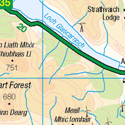
OS Map of An Cabar
Height: 558m / 1832ft • Prominence: 250m / 820ft • Summit : rock 5m NW of trig point • Trip reports (hill-bagging)

S9494 - An Cabar
NH257641, LR20. HISTORY Pillar completed 8th July 1957 costing £27.5s.5d. Computed as tertiary triangulation station NH16/T17 within the Wester Ross secondary block during 1958. Flush bracket S9494 was levelled for height to first class precision, tertiary standards in July 1958. This pillar station was last maintained by the Ordnance Survey in June 1988. SITE VISIT Overall approach from the southwest. Parked in a large layby on the south side of A832 at NH 23906 61288. A good track leaves the north side of the A832 at NH 24219 61393. This track only appears on some maps. Once over the locked deer gate this track leads up through the woods joining what was a mapped path and continues onto the open deer moor until NH 24196 62510 (~312m height). After the track ends, it is a straight-forward route upwards of around 2km northeast across heather and occasional bogs until the summit is reached. Standard Hotine triangulation column. The pillar trunk has sustained damage below the flush bracket, otherwise is still in reasonable condition. The spider retains its original OS centre cap with deep indented letters. The flush bracket faces northwest, compass measurement 300°. Vented through the front and right sight holes. Full 360° panoramic view from top. Photographed: 11th July 2022, GRP. ═════════════════════════ Interactive index: www.google.com/maps/d/viewer?mid=1arx2Qmo5mVeVUJA2lzVG_uzbYPW59ffh&ll=57.633122,-4.920509&z=10" rel="noreferrer nofollow Google My Maps Panorama: www.360cities.net/image/ancabar" rel="noreferrer nofollow www.360cities.net/image/ancabar Map: www.flickr.com/photos/13460108@N06/38555230910 Trig Pillars on OS Landranger 20 ═════════════════════════ Neighbouring Triangulation Pillars S9495 - Sgurr A'Mhuilinn : 5.22 miles to the south. S9500 - Sgurr Nan Clach Geala : 6.45 miles to the NW un79 - Sgurr Marcasaidh : 6.72 miles to the ESE www.flickr.com/photos/13460108@N06/52214458882/in/album-72157631831281682/ S9416 - Fionn Bheinn : 6.93 miles to the west. www.flickr.com/photos/13460108@N06/52215946160/in/album-72157631831281682/ S9429 - Carn Mhartuin : 7.90 miles to the SW. www.flickr.com/photos/13460108@N06/52290697323/in/album-72157631874189130/ un27 - Carn Na Dubh Choille : 8.30 miles to the ENE. S8136 - Carn Na Coinnich : 9.12 miles to the SSE. S9440 - Meallan Chuaich : 9.23 miles to the WNW. ═════════════════════════
11-Jul-22 • Graeme5015 • flickr
s9494 9494 ancabar cabar achanalt 52215947520


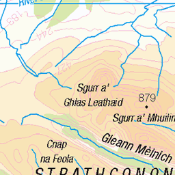
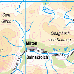
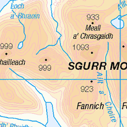
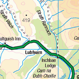
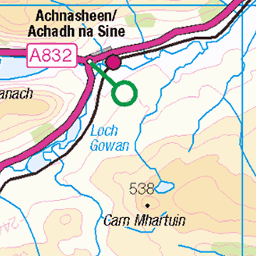
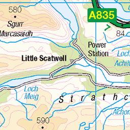
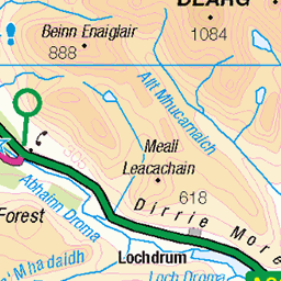
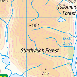
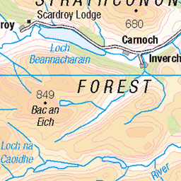
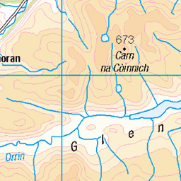
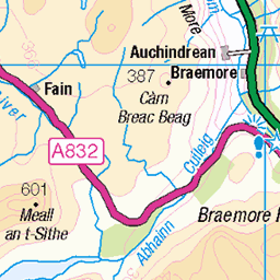
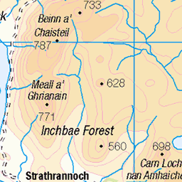
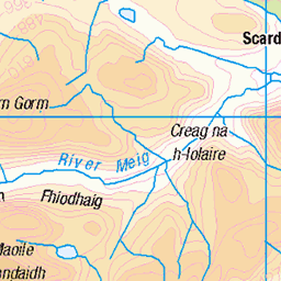
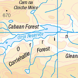
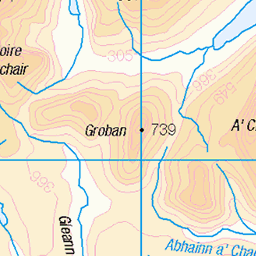
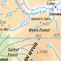
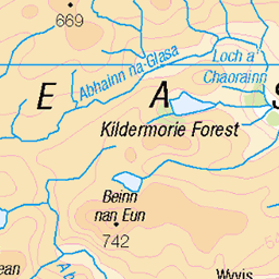
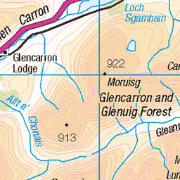
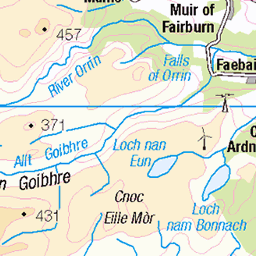
OS Map
This is OS mapping. In some areas, OpenStreetMap shows more footpaths
Spatial NI has online OSNI mapping. Click "Basemap Gallery" (4 squares icon at the top).
Now would be a good time for a cup of tea.

GPX Editor
Record map clicks
Reload map
Photos
Please tag your photos and upload them to the British and Irish Mountains group on Flickr
The other photos have been geo-tagged as on or around the summit. For less busy mountains, it can be a little hit and miss.
S9494 - An Cabar
NH257641, LR20. HISTORY Pillar completed 8th July 1957 costing £27.5s.5d. Computed as tertiary triangulation station NH16/T17 within the Wester Ross secondary block during 1958. Flush bracket S9494 was levelled for height to first class precision, tertiary standards in July 1958. This pillar station was last maintained by the Ordnance Survey in June 1988. SITE VISIT Overall approach from the southwest. Parked in a large layby on the south side of A832 at NH 23906 61288. A good track leaves the north side of the A832 at NH 24219 61393. This track only appears on some maps. Once over the locked deer gate this track leads up through the woods joining what was a mapped path and continues onto the open deer moor until NH 24196 62510 (~312m height). After the track ends, it is a straight-forward route upwards of around 2km northeast across heather and occasional bogs until the summit is reached. Standard Hotine triangulation column. The pillar trunk has sustained damage below the flush bracket, otherwise is still in reasonable condition. The spider retains its original OS centre cap with deep indented letters. The flush bracket faces northwest, compass measurement 300°. Vented through the front and right sight holes. Full 360° panoramic view from top. Photographed: 11th July 2022, GRP. ═════════════════════════ Interactive index: www.google.com/maps/d/viewer?mid=1arx2Qmo5mVeVUJA2lzVG_uzbYPW59ffh&ll=57.633122,-4.920509&z=10" rel="noreferrer nofollow Google My Maps Panorama: www.360cities.net/image/ancabar" rel="noreferrer nofollow www.360cities.net/image/ancabar Map: www.flickr.com/photos/13460108@N06/38555230910 Trig Pillars on OS Landranger 20 ═════════════════════════ Neighbouring Triangulation Pillars S9495 - Sgurr A'Mhuilinn : 5.22 miles to the south. S9500 - Sgurr Nan Clach Geala : 6.45 miles to the NW un79 - Sgurr Marcasaidh : 6.72 miles to the ESE www.flickr.com/photos/13460108@N06/52214458882/in/album-72157631831281682/ S9416 - Fionn Bheinn : 6.93 miles to the west. www.flickr.com/photos/13460108@N06/52215946160/in/album-72157631831281682/ S9429 - Carn Mhartuin : 7.90 miles to the SW. www.flickr.com/photos/13460108@N06/52290697323/in/album-72157631874189130/ un27 - Carn Na Dubh Choille : 8.30 miles to the ENE. S8136 - Carn Na Coinnich : 9.12 miles to the SSE. S9440 - Meallan Chuaich : 9.23 miles to the WNW. ═════════════════════════
11-Jul-22 • Graeme5015 • flickr
s9494 9494 ancabar cabar achanalt 52215947520


An Coileachan and Loch Fannich
from the slopes of An Cabar
05-Jun-10 • Donald Noble • flickr
water marilyn landscape scotland dam hill engineering hills loch munro rossshire 4761142894

Dam Pointless?
The (almost redundant) dam at the eastern end of Loch Fannich, from the slopes of An Cabar
05-Jun-10 • Donald Noble • flickr
water marilyn landscape dam hill engineering hills hydro loch hydropower 4674601273
Videos
YouTube Channel Contact: Email: ketracell78@gmail.com The Incident: ...
Notes
- Data: Database of British and Irish Hills v18.2
- Maps: We use OS mapping for England, Scotland, Wales, and the Isle of Man. Sadly, Channel Islands, Northern (OSNI) and Southern Ireland (OSI) mapping isn't available online, so we use Openstreetmap.