Hills of Britain and Ireland
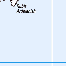
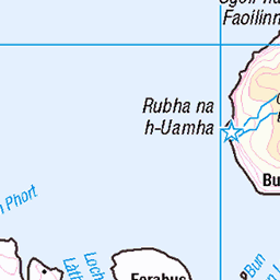
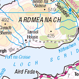
OS Map of Eilean Dubh

IMGP8970
Sea birds take flight from the ocean near Mull.
20-Jul-23 • mattbuck4950 • flickr
unitedkingdom photosbymatt camerapentaxk70 lenssigma18300mm water onboatphotos scotland visitswithheathermcrae birds strathclyde july atlanticocean visitswithhenriettamcrae visitswithfinlaymcrae 2023 53314760882

IMGP8971
Sea birds take flight from the ocean near Mull.
20-Jul-23 • mattbuck4950 • flickr
unitedkingdom photosbymatt camerapentaxk70 lenssigma18300mm water onboatphotos scotland visitswithheathermcrae birds strathclyde july atlanticocean visitswithhenriettamcrae visitswithfinlaymcrae 2023 53315871463

june-2021_014
From a series of images taken on a trip to Mull May/Jun 2021
01-Jun-21 • Alph Thomas • flickr
digitalphotography photography landscape scotland mull erraid 51248440543

june-2021_015
From a series of images taken on a trip to Mull May/Jun 2021
01-Jun-21 • Alph Thomas • flickr
digitalphotography photography landscape scotland mull erraid 51249298760

june-2021_016
From a series of images taken on a trip to Mull May/Jun 2021
01-Jun-21 • Alph Thomas • flickr
digitalphotography photography landscape scotland mull erraid 51247531427

june-2021_017
From a series of images taken on a trip to Mull May/Jun 2021
01-Jun-21 • Alph Thomas • flickr
digitalphotography photography landscape scotland mull erraid 51247531372
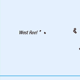
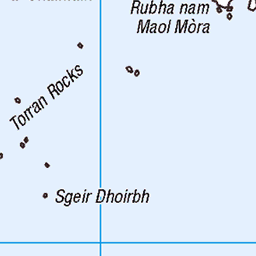
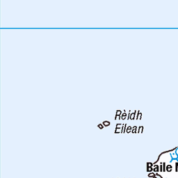
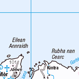
OS Map
This is OS mapping. In some areas, OpenStreetMap shows more footpaths
Spatial NI has online OSNI mapping. Click "Basemap Gallery" (4 squares icon at the top).
Now would be a good time for a cup of tea.


GPX Editor
Record map clicks
Reload map
Photos
Please tag your photos and upload them to the British and Irish Mountains group on Flickr
The other photos have been geo-tagged as on or around the summit. For less busy mountains, it can be a little hit and miss.
IMGP8970
Sea birds take flight from the ocean near Mull.
20-Jul-23 • mattbuck4950 • flickr
unitedkingdom photosbymatt camerapentaxk70 lenssigma18300mm water onboatphotos scotland visitswithheathermcrae birds strathclyde july atlanticocean visitswithhenriettamcrae visitswithfinlaymcrae 2023 53314760882
IMGP8971
Sea birds take flight from the ocean near Mull.
20-Jul-23 • mattbuck4950 • flickr
unitedkingdom photosbymatt camerapentaxk70 lenssigma18300mm water onboatphotos scotland visitswithheathermcrae birds strathclyde july atlanticocean visitswithhenriettamcrae visitswithfinlaymcrae 2023 53315871463
june-2021_014
From a series of images taken on a trip to Mull May/Jun 2021
01-Jun-21 • Alph Thomas • flickr
digitalphotography photography landscape scotland mull erraid 51248440543
june-2021_015
From a series of images taken on a trip to Mull May/Jun 2021
01-Jun-21 • Alph Thomas • flickr
digitalphotography photography landscape scotland mull erraid 51249298760
june-2021_016
From a series of images taken on a trip to Mull May/Jun 2021
01-Jun-21 • Alph Thomas • flickr
digitalphotography photography landscape scotland mull erraid 51247531427
june-2021_017
From a series of images taken on a trip to Mull May/Jun 2021
01-Jun-21 • Alph Thomas • flickr
digitalphotography photography landscape scotland mull erraid 51247531372


10541 Eilean Dubh a
Coastal Connection trip organised by Mervin Jack, clockwise round Mull. Five island of the nine main targets. Name:Eilean Dubh Hill number:10541 Height:36m / 118ft Parent (Ma):none RHB Section:17E: Mull and Nearby Islands County/UA:Argyll and Bute (UA) Island:Mono Tump island Maritime area:Mull & surrounding islands Class:Tump (0-99m), SIB Grid ref:NM 28635 19626 Summit feature:outcrop Drop:36m Col:Sea
24-Aug-19 • Dugswell2 • flickr
eileandubh p36 tump sib 48635124751


10541 Cnoc Carpach
The highest sand dune on the Isle of Coll with Iain Brown and Martin Richardson after Calgary Point and Ben Feall. Name:Cnoc Carpach Hill number:10514 Height:53m / 174ft Parent (Ma/M):none Area:17F: Coll and Tiree Class:0 Grid ref:NM 14905 53992 Summit feature:no feature: sand dune Drop:38m Col:15m NM150547
11-May-14 • Dugswell2 • flickr
p38 tump isleofcoll cnoccarpach 14228764641

10541 Cnoc Carpach 1
The highest sand dune on the Isle of Coll with Iain Brown and Martin Richardson after Calgary Point and Ben Feall. Name:Cnoc Carpach Hill number:10514 Height:53m / 174ft Parent (Ma/M):none Area:17F: Coll and Tiree Class:0 Grid ref:NM 14905 53992 Summit feature:no feature: sand dune Drop:38m Col:15m NM150547
11-May-14 • Dugswell2 • flickr
p38 tump isleofcoll cnoccarpach 14045413549

10541 Cnoc Carpach 2
The highest sand dune on the Isle of Coll with Iain Brown and Martin Richardson after Calgary Point and Ben Feall. Name:Cnoc Carpach Hill number:10514 Height:53m / 174ft Parent (Ma/M):none Area:17F: Coll and Tiree Class:0 Grid ref:NM 14905 53992 Summit feature:no feature: sand dune Drop:38m Col:15m NM150547
11-May-14 • Dugswell2 • flickr
p38 tump isleofcoll cnoccarpach 14045497157

10541 Cnoc Carpach 3
The highest sand dune on the Isle of Coll with Iain Brown and Martin Richardson after Calgary Point and Ben Feall. Name:Cnoc Carpach Hill number:10514 Height:53m / 174ft Parent (Ma/M):none Area:17F: Coll and Tiree Class:0 Grid ref:NM 14905 53992 Summit feature:no feature: sand dune Drop:38m Col:15m NM150547
11-May-14 • Dugswell2 • flickr
p38 tump isleofcoll cnoccarpach 14045416999
Videos
None found
Notes
- Data: Database of British and Irish Hills v18.2
- Maps: We use OS mapping for England, Scotland, Wales, and the Isle of Man. Sadly, Channel Islands, Northern (OSNI) and Southern Ireland (OSI) mapping isn't available online, so we use Openstreetmap.