Hills of Britain and Ireland
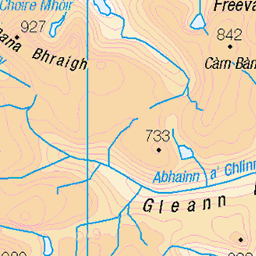
OS Map of Sgurr nan Each


Distant An Teallach
The distinctive outline of An Teallach from the slopes of Sgùrr nan Each.
28-Jul-24 • Russell-Davies • flickr
sgùrrnaneach anteallach fannichs munrobagging munros munro ullapool hiking canon canonr6 clouds highlands landscape mountain mountains scotland summer uk 54205716066


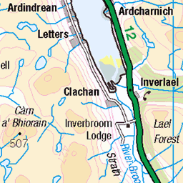
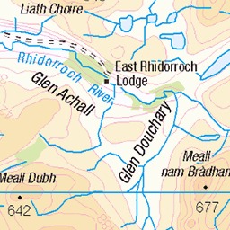
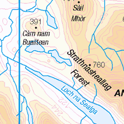
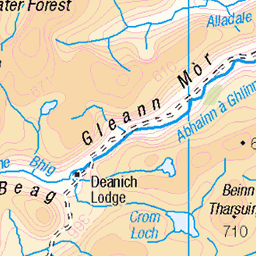
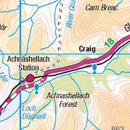
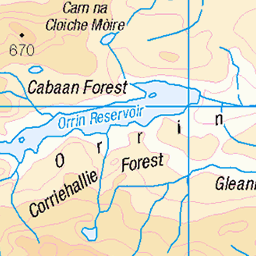
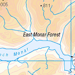
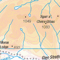
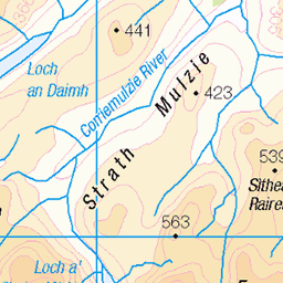
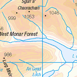
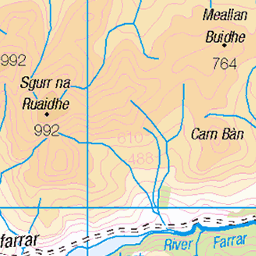
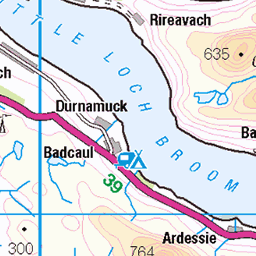
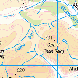
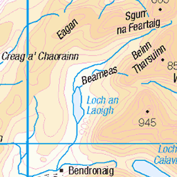
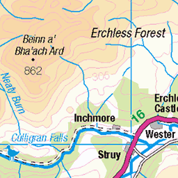
OS Map
This is OS mapping. In some areas, OpenStreetMap shows more footpaths
Spatial NI has online OSNI mapping. Click "Basemap Gallery" (4 squares icon at the top).
Now would be a good time for a cup of tea.


GPX Editor
Record map clicks
Reload map
Photos
Please tag your photos and upload them to the British and Irish Mountains group on Flickr
The other photos have been geo-tagged as on or around the summit. For less busy mountains, it can be a little hit and miss.
Distant An Teallach
The distinctive outline of An Teallach from the slopes of Sgùrr nan Each.
28-Jul-24 • Russell-Davies • flickr
sgùrrnaneach anteallach fannichs munrobagging munros munro ullapool hiking canon canonr6 clouds highlands landscape mountain mountains scotland summer uk 54205716066


Videos
In today's video I will be climbing The West Fannichs! These are located near the Scottish Town of Ullapool! THE ROUTE: ...
YouTube Channel Contact: Email: ketracell78@gmail.com The Incident: ...
The 5 western Fannichs, near Ullapool. A' Chailleach, Sgùrr Breac, Sgùrr nan Each, Sgùrr nan Clach Geala and Meall a' ...
A beautiful 15 mile hike topping 5 Munro's with a lovely cloud inversion thrown in. Munro's climbed - A' Chailleach(The old ...
Notes
- Data: Database of British and Irish Hills v18.2
- Maps: We use OS mapping for England, Scotland, Wales, and the Isle of Man. Sadly, Channel Islands, Northern (OSNI) and Southern Ireland (OSI) mapping isn't available online, so we use Openstreetmap.