Hills of Britain and Ireland
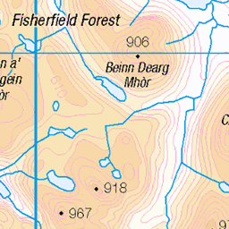
OS Map of Beinn Tarsuinn
Height: 934m / 3064ft • Prominence: 207m / 679ft • Summit : cairn on rock • Trip reports (hill-bagging)

Mullach Coire Mhic Fhearchair
Nearly at the summit of the highest peak in the Fisherfield area. A sensational viewpoint, as they all were to be fair. The other peak, to the right, is Beinn Tarsuinn. It was probably around this time (now being able to see the entire 'Fisherfield Round' and the distances involved) that I was exceedingly thankful not to be doing the entire lot in one go.
17-May-24 • OutdoorMonkey • flickr
mullachcoiremhicfhearchair mcmf fisherfield summit peak munro mountain mountainside boulder rock remote wild wilderness natural nature scenic scenery outside outdoor bluesky scotland highlands 53736992180

photo
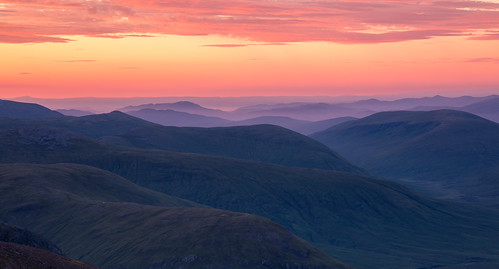
The summit of the Fisherfield’s highest peak - Mullach Coire Mhic Fhearchair, with Sgurr Ban beyond it, and An Teallach in the distance beyond that. Also looking down Gleann na Muice to Loch na Sealga. Shenavall bothy is down there too, somewhere, although I suspect just behind Sgurr Ban's mountainside from this angle.
17-May-24 • OutdoorMonkey • flickr
mullachcoiremhicfhearchair mcmf sgurrban gleannnamuice lochnasealga fisherfield scotland highlands remote wild wilderness mountain mountainside summit peak munro bluesky outside outdoor rural countryside nature natural scenic scenery rock boulder valley glen 53735710737

photo
A view from Beinn Tarsuinn, one of the Fisherfield peaks. The water on the left is Lochan Fada, and the peak on the right is A' Mhaighdean, and of course the famous 'tennis court' just along the ridge.
17-May-24 • OutdoorMonkey • flickr
fisherfield scotland highlands remote wild wilderness outside outdoor rural nature natural scenic scenery mountain mountains munro peak summit 53737166845

The Great Wilderness
A compressed panorama to squeeze in the whole 'Fisherfield Round' of six peaks (five munros and a corbett) surrounding Gleann na Muice. The peaks appear a lot more 'pointy' here than they are in real-life but this is the view looking more-or-less north from Beinn Tarsuinn at the head of the glen.
17-May-24 • OutdoorMonkey • flickr
fisherfield wilderness wild remote thegreatwilderness peak peaks summit munro corbett mountain mountains mountainside outside outdoor nature natural scenic scenery scotland highlands beinnachlaidheimh sgurrban mullachcoiremhicfhearchair mcmf beinntarsuinn amhaighdean ruadhstacmòr 53737238950

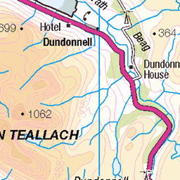
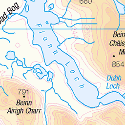
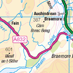
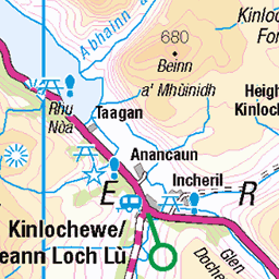
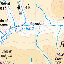
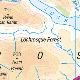
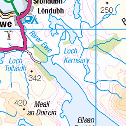
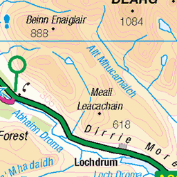
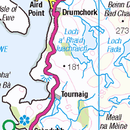
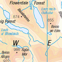
OS Map
This is OS mapping. In some areas, OpenStreetMap shows more footpaths
Spatial NI has online OSNI mapping. Click "Basemap Gallery" (4 squares icon at the top).
Now would be a good time for a cup of tea.


GPX Editor
Record map clicks
Reload map
Photos
Please tag your photos and upload them to the British and Irish Mountains group on Flickr
The other photos have been geo-tagged as on or around the summit. For less busy mountains, it can be a little hit and miss.
Mullach Coire Mhic Fhearchair
Nearly at the summit of the highest peak in the Fisherfield area. A sensational viewpoint, as they all were to be fair. The other peak, to the right, is Beinn Tarsuinn. It was probably around this time (now being able to see the entire 'Fisherfield Round' and the distances involved) that I was exceedingly thankful not to be doing the entire lot in one go.
17-May-24 • OutdoorMonkey • flickr
mullachcoiremhicfhearchair mcmf fisherfield summit peak munro mountain mountainside boulder rock remote wild wilderness natural nature scenic scenery outside outdoor bluesky scotland highlands 53736992180
photo
The summit of the Fisherfield’s highest peak - Mullach Coire Mhic Fhearchair, with Sgurr Ban beyond it, and An Teallach in the distance beyond that. Also looking down Gleann na Muice to Loch na Sealga. Shenavall bothy is down there too, somewhere, although I suspect just behind Sgurr Ban's mountainside from this angle.
17-May-24 • OutdoorMonkey • flickr
mullachcoiremhicfhearchair mcmf sgurrban gleannnamuice lochnasealga fisherfield scotland highlands remote wild wilderness mountain mountainside summit peak munro bluesky outside outdoor rural countryside nature natural scenic scenery rock boulder valley glen 53735710737
photo
A view from Beinn Tarsuinn, one of the Fisherfield peaks. The water on the left is Lochan Fada, and the peak on the right is A' Mhaighdean, and of course the famous 'tennis court' just along the ridge.
17-May-24 • OutdoorMonkey • flickr
fisherfield scotland highlands remote wild wilderness outside outdoor rural nature natural scenic scenery mountain mountains munro peak summit 53737166845
The Great Wilderness
A compressed panorama to squeeze in the whole 'Fisherfield Round' of six peaks (five munros and a corbett) surrounding Gleann na Muice. The peaks appear a lot more 'pointy' here than they are in real-life but this is the view looking more-or-less north from Beinn Tarsuinn at the head of the glen.
17-May-24 • OutdoorMonkey • flickr
fisherfield wilderness wild remote thegreatwilderness peak peaks summit munro corbett mountain mountains mountainside outside outdoor nature natural scenic scenery scotland highlands beinnachlaidheimh sgurrban mullachcoiremhicfhearchair mcmf beinntarsuinn amhaighdean ruadhstacmòr 53737238950


On the east ridge of Mullach Coire Mhic Fhearchair
20-May-14 • Nick Bramhall • flickr
sh 14124462288
Videos
Mountains in all directions... Taken on my Fisherfield 6 round on 29th May 2023.
a spicy hike on Beinn Tarsuinn ridge.
On the coast of Wester Ross lies one of Scotlands wildest areas, a large expanse of roadless mountain and moorland country. this ...
I met up with my 2 pals at Incheril walkers car park in Kinlochewe with a promising forecast for the Munros the following day.
I hiked alone for four days and nights in Fisherfield, often referred to as the Great Wilderness (of Scotland). More ASMR no talking ...
Notes
- Data: Database of British and Irish Hills v18.2
- Maps: We use OS mapping for England, Scotland, Wales, and the Isle of Man. Sadly, Channel Islands, Northern (OSNI) and Southern Ireland (OSI) mapping isn't available online, so we use Openstreetmap.