Hills of Britain and Ireland
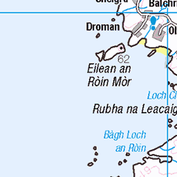
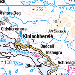
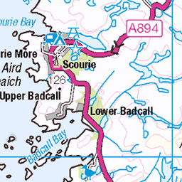
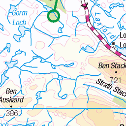
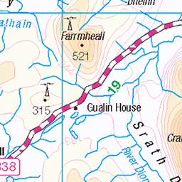
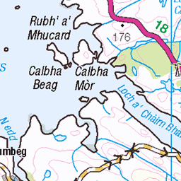
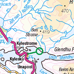
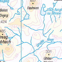
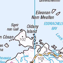
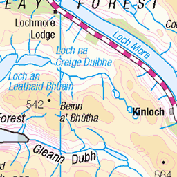
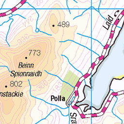
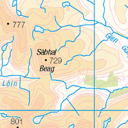
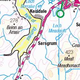
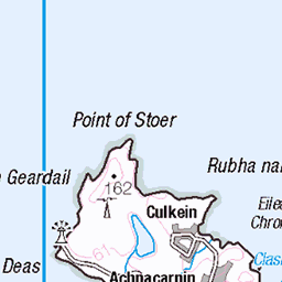
OS Map of Eilean a' Mhadaidh
Height: 38m / 125ft • Prominence: 38m / 125ft • Trip reports (hill-bagging)

155-20180511_Tarbet Road Walk-Sutherland-view NE to inlet of Loch Laxford from S end of scattered hamlet of Foindle
11-May-18 • Nick Kaye • flickr
scotland sutherland highlands landscape 30449682178

157-20180511_Tarbet Road Walk-Sutherland-view ENE from Foindle across Loch Laxford-L-R Farrmheall, Beinn Spionnaidh, Cranstackie, Foinaven
11-May-18 • Nick Kaye • flickr
scotland sutherland highlands landscape coast 44269201282

156-20180511_Tarbet Road Walk-Sutherland-deserted old cottage in hamlet of Foindle
11-May-18 • Nick Kaye • flickr
scotland sutherland highlands landscape house 29380926147

158-20180511_Tarbet Road Walk-Sutherland-view NW along road from Foindle heading in direction of Fanagmore
11-May-18 • Nick Kaye • flickr
scotland sutherland highlands landscape 30449783898

159-20180511_Tarbet Road Walk-Sutherland-view NW along road from Foindle heading in direction of Fanagmore
11-May-18 • Nick Kaye • flickr
scotland sutherland highlands landscape 30449779338
OS Map
This is OS mapping. In some areas, OpenStreetMap shows more footpaths
Spatial NI has online OSNI mapping. Click "Basemap Gallery" (4 squares icon at the top).
Now would be a good time for a cup of tea.


GPX Editor
Record map clicks
Reload map
Photos
Please tag your photos and upload them to the British and Irish Mountains group on Flickr
The other photos have been geo-tagged as on or around the summit. For less busy mountains, it can be a little hit and miss.
155-20180511_Tarbet Road Walk-Sutherland-view NE to inlet of Loch Laxford from S end of scattered hamlet of Foindle
11-May-18 • Nick Kaye • flickr
scotland sutherland highlands landscape 30449682178
157-20180511_Tarbet Road Walk-Sutherland-view ENE from Foindle across Loch Laxford-L-R Farrmheall, Beinn Spionnaidh, Cranstackie, Foinaven
11-May-18 • Nick Kaye • flickr
scotland sutherland highlands landscape coast 44269201282
156-20180511_Tarbet Road Walk-Sutherland-deserted old cottage in hamlet of Foindle
11-May-18 • Nick Kaye • flickr
scotland sutherland highlands landscape house 29380926147
158-20180511_Tarbet Road Walk-Sutherland-view NW along road from Foindle heading in direction of Fanagmore
11-May-18 • Nick Kaye • flickr
scotland sutherland highlands landscape 30449783898
159-20180511_Tarbet Road Walk-Sutherland-view NW along road from Foindle heading in direction of Fanagmore
11-May-18 • Nick Kaye • flickr
scotland sutherland highlands landscape 30449779338


Ein Blümchen
Ich weiß leider nicht, wie sie heißen
flowers plants flower scotland pflanzen blumen schottland grosbritannien 27593602066
Videos
None found
Notes
- Data: Database of British and Irish Hills v18.2
- Maps: We use OS mapping for England, Scotland, Wales, and the Isle of Man. Sadly, Channel Islands, Northern (OSNI) and Southern Ireland (OSI) mapping isn't available online, so we use Openstreetmap.